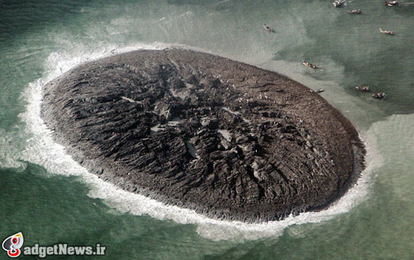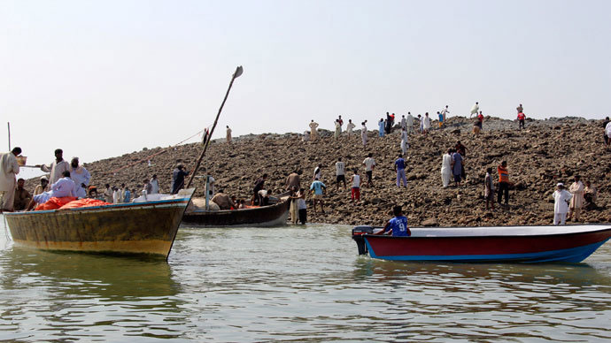
عکسهای جزیرهای که اخیرا در منطقهای ساحلی در کشور پاکستان سر از آب برآورده این بار توسط ناسا منتشر شده است. زلزلهی ویرانگری که چند روز پیش (دوم مهر ماه) در پاکستان رخ داد و 500 کشته و زخمی بر جای گذاشت، باعث به وجود آمدن یک جزیره شده است. گفته میشود که این جزیره در فاصلهی 380 کیلومتری مرکز زمین لرزه پدیدار شده است.

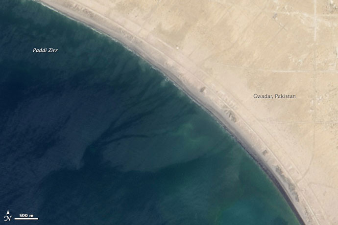
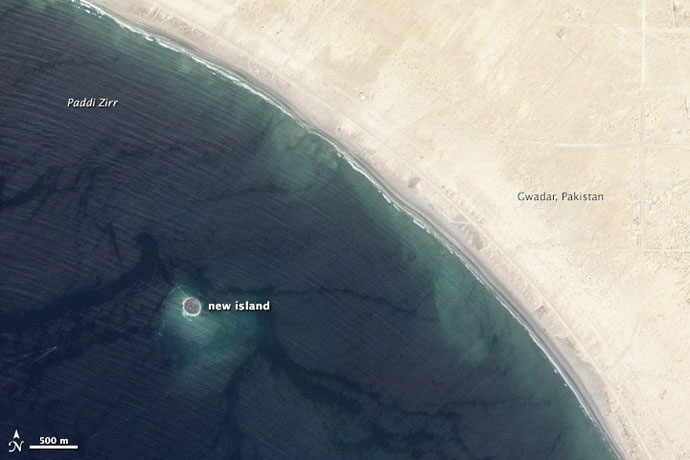
برای مقایسه، دو عکس قبل و بعد زلزله از همان منطقه را به ترتیب در بالا و پایین این متن مشاهده میکنید. عکس پایین جزیرهای را که به تازگی بوجود آمده، نشان میدهد. این جزیره «Zalzala Jazeera» (جزیرهی زلزلهای) نامگذاری شده است. طبق اظهارات دانشمندان به واسطهی عمق کم آب در این منطقهی ساحلی که حدود 15 الی 20 متر برآورد میشود، شرایط تشکیل این جزیره فراهم شده است.

دانشمندان این «جزیرهی زلزلهای» را فقط یک تودهی بزرگ از گل و لای کف اقیانوس توصیف کردهاند که تحت فشار به سطح آب آمده است. علاوه بر این آنها معتقدند که این جزیره عمر زیادی نخواهد داشت و تقریبا تا یک سال دیگر دوباره به زیر آب خواهد رفت!

منبع : eteknix
NASA Reveal Images Of A New Island That Emerged After Pakistan Earthquake
NASA have released a few images showing an Island that newly formed off the coast of Pakistan on September 24th. The island formed after a devastating earthquake struck mainland Pakistan causing over 500 fatalities, RT reports. However, one of the consequences of that quake was this new island which formed 380 kilometres from its epicentre in Paddi Zirr Bay near Gwadar, Pakistan, in the Arabian Sea.
Two comparative shots of the same area just a few months between, April 17th above and September 26th below, show the newly formed island popping up offshore. The new island is called “Zalzala Jazeera” literally meaning earthquake island. Scientists say the formation of the new island in the area is due to the relatively low water level of 15 to 20 metres.
The Zalzala Jazeera island is described by scientists as “just a big pile of mud from the seafloor that got pushed up”. The island will not last very long and scientists claim the island will remain above sea level for about a year before sinking back to the bottom again.
 گجت نیوز آخرین اخبار تکنولوژی، علم و خودرو


